Every Storm That Ever Wrecked This Place
A source-backed history of the hurricanes, floods, and wildfires—from Hazel to Covington Drive—that reshaped the Grand Strand.
Category: local | Published: 2026-08-12
My first hurricane was Hugo, and I was nowhere near the ocean.
I was in Charlotte. Two hundred miles inland, which everybody up there assumed was a safe distance right up until the morning of September 22, 1989.
Hugo came ashore near Charleston at midnight and then ran north at 35 miles an hour. That's the part that got Charlotte. A hurricane that moves that fast doesn't have time to weaken. It covered the 175 miles from the coast in five hours and was crossing I-77 by 5 a.m., still a hurricane in every way that mattered. The airport clocked a 63 mph gust as the center went by. Later that morning the winds gusted to 100.
The sun came up on a city buried in trees. Windows blown out of the downtown skyscrapers. WSOC's antenna tower folded over onto the station. Something like 85 to 90 percent of the city with no power, and some neighborhoods waited two weeks to get it back. Three people died in the Charlotte area.
Here's the part I still think about.
Twenty-nine years later I'm living on the Grand Strand, Florence is coming, and I get in the car and drive to Charlotte to wait it out. Straight to the city that Hugo had flattened. That's how safe inland feels when you're looking at a hurricane on the coast.
I was gone about two weeks. Florence hit North Carolina on September 14th, 2018 and crawled — at one point it was moving two miles an hour, slower than you walk. And I'm up in Charlotte watching it on TV thinking, alright, it went north of us, we got lucky.
Then I came back and Conway was underwater. Not from rain that fell on Conway. From rain that had fallen days earlier and hundreds of miles away, working its way down the Waccamaw on its own schedule. Nearly a thousand homes and businesses flooded. Some of them stayed flooded for weeks. There were crews stacking concrete barriers and sand against the 501 bridges to keep the main road into Myrtle Beach open.
I had evacuated for the wind and the wind was never the problem.
That's the thing nobody tells you when you move here, and I had it exactly backwards. Inland, a hurricane is a wind event and it's over when the wind stops — that's the Hugo version, and it's the one I grew up with. On the Grand Strand the wind is the opening act. The water shows up later, from upstream, days after the sky clears and the tourists have gone home thinking they dodged one.
Every generation on this coast learns some version of that the hard way, and then the next batch of transplants shows up and has to learn it again. I was one of them.
So here's the whole record. Every major hurricane, flood, and fire that's rearranged the Grand Strand. Everything below is sourced and linked, because half of what gets passed around about these storms is wrong, and the real numbers are worse than the exaggerations anyway. Before any beach day, keep the rip-current survival guide close too.
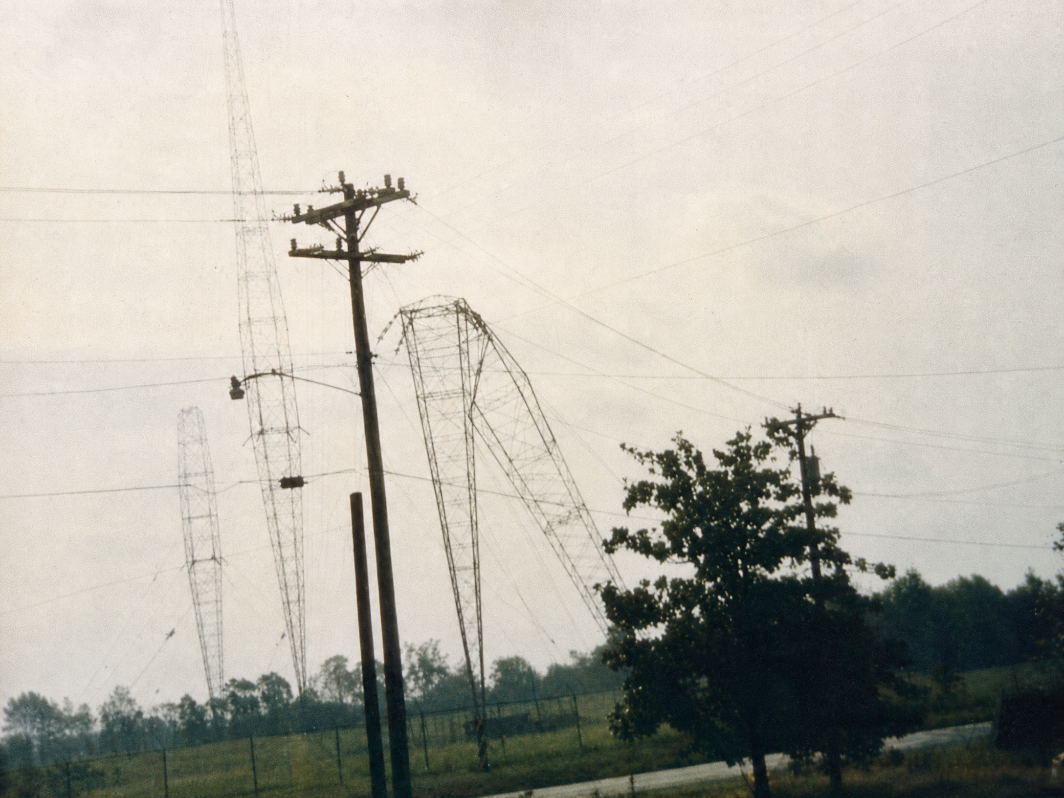
Photo: PR10000 / Wikimedia Commons — public domain release by the copyright holder. Hugo brought down broadcast towers across Charlotte, including this one — 200 miles from where the storm came ashore.
Hazel, October 15, 1954
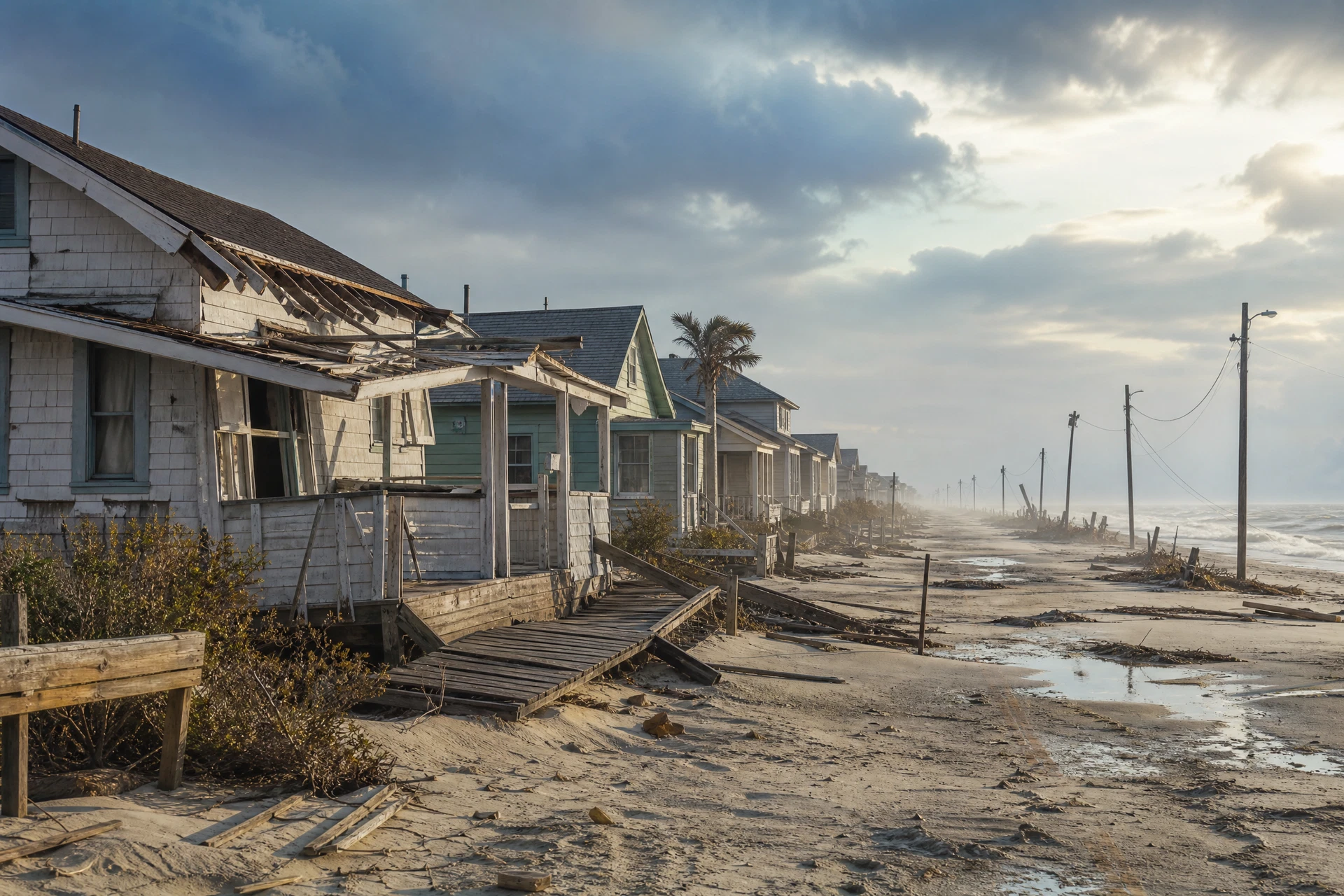
AI-generated editorial illustration — not a historical photograph. This original artwork provides historical context only and does not depict an actual Hazel scene, building, or location.
Every old-timer measures storms against Hazel. There's a reason.
Hazel came ashore as a Category 4 right at the state line near Little River on the morning of October 15th. It arrived on the highest lunar tide of the year, which is roughly the worst luck available, and pushed a storm surge up to 18 feet.
Eighty percent of the oceanfront homes in Myrtle Beach were destroyed. Not damaged. Destroyed. Myrtle Beach clocked a wind gust of 106 mph. The surge took out every single fishing pier along 170 miles of coastline.
The Horry County Archives keep the count by community: 273 houses gone in Myrtle Beach, 450 at Ocean Drive, 300 at Cherry Grove, 200 at Crescent Beach, 120 at Windy Hill. The Weather Bureau in Raleigh put it plainly — basically everything on the immediate waterfront between the state line and Cape Fear was wiped off the map.
And here's the thing that gets me every time. There was no warning system. The radio station had gone off the air. Myrtle Beach firefighters cranked a leftover World War II siren, and volunteers drove up and down the boulevard with loudspeakers strapped to their cars yelling at people to get out.
Hazel killed something like a thousand people on its way from Haiti to Canada. In South Carolina, one death. That's not skill. That's luck, and it's the kind of luck you don't get twice.
They retired the name permanently.
Sources: City of Myrtle Beach · NOAA AOML · SC DNR impact report (PDF) · Post & Courier · CCU photo archive
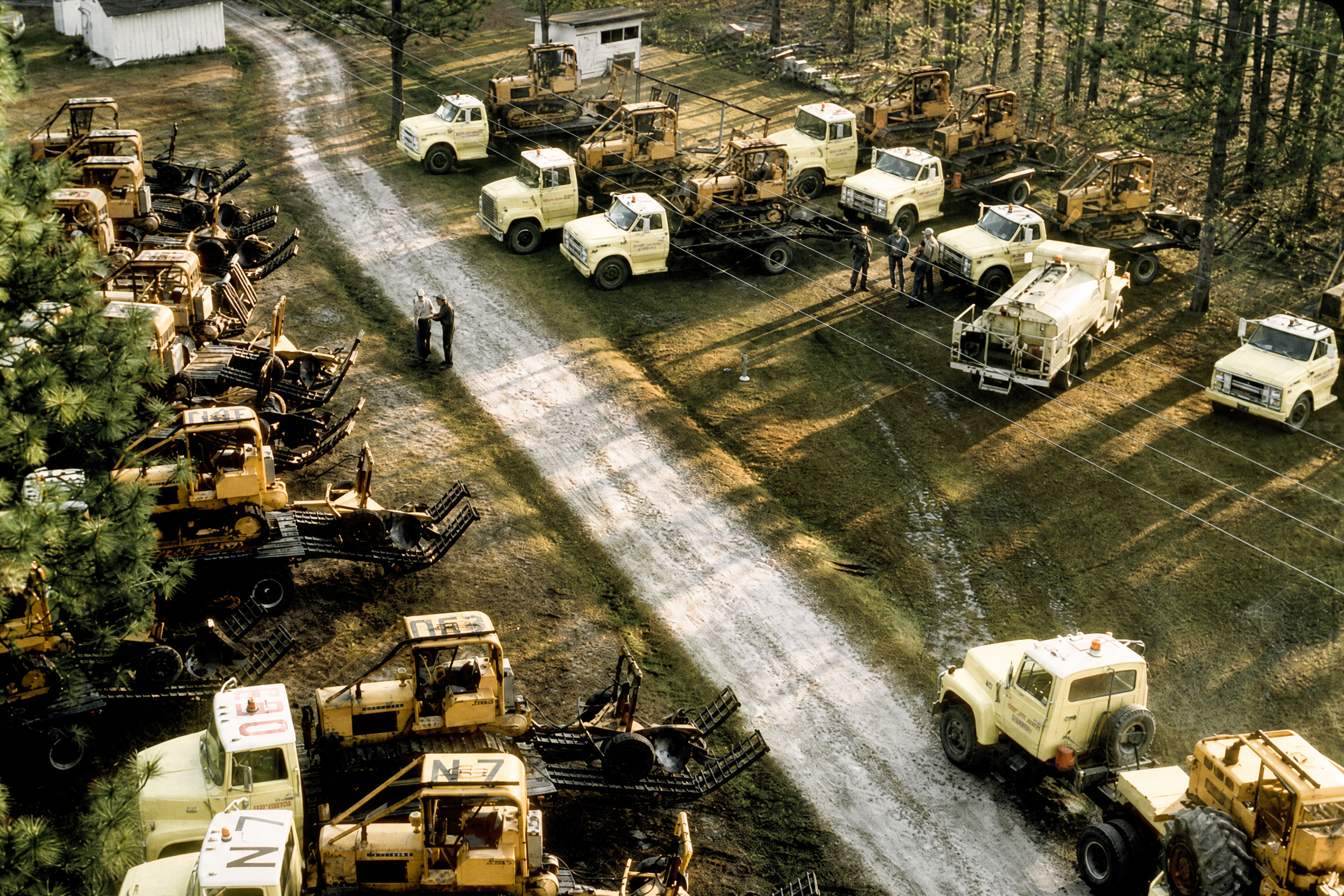
Photo: South Carolina Forestry Commission — the photograph documents suppression planning during the Clear Pond Fire in April 1976.
The Fires Nobody Remembers, 1954 and 1976
Hurricanes get the anniversary coverage. Fire has been quietly burning through Horry County the whole time.
The Bombing Range Fire started June 27, 1954 — same year as Hazel, which is a rough twelve months for one county. Probably a tossed cigarette during a brutal heat wave. It burned 10,162 acres over nine days.
Then in 1976, the Clear Pond Fire took roughly 30,000 acres northwest of Myrtle Beach. Largest wildfire in South Carolina history at the time. It burned through the same Carolina Bay country that would catch fire again in 2009 and again in 2025.
That's not coincidence. It's the ground. Peat soil under waxy scrub and pine, and once it's dry, it stays lit.
Sources: WMBF wildfire history · NWS Wilmington
Hugo, September 21–22, 1989
Hugo made landfall near Sullivan's Island around midnight as a Category 4. Charleston took the direct hit and got the headlines. We caught the right side of the storm, which is the side you don't want.
The storm tide at Myrtle Beach hit 13 feet. Down at Bulls Bay near landfall, debris marks later put it at 20.
Garden City got erased. Up to 90 percent of the oceanfront homes, gone. The pier, gone. Sand piled up on roads three blocks inland. The Horry County administrator told reporters that Garden City, for all practical purposes, was gone, and the fact that a county official said that out loud on the record tells you what it looked like out there.
Surfside's pier was destroyed. Springmaid was chewed down to a 150-foot stub, and two other Myrtle Beach piers were destroyed outright. Myrtle Beach gusted to 76 mph, lost the bulk of its protective dunes, and had about 150 wooden beach access walkways torn out. The current Grand Strand fishing-pier guide is a useful look at the working piers that remain part of the coast today.
At Pawleys Island the surge cut the island in two. It carved a brand new inlet straight through — news reports at the time put it at anywhere from 20 to 100 feet wide — destroyed at least 14 homes, and picked up three more and set them down in the tidal creek behind the island. In Murrells Inlet the marina was destroyed along with a large diesel spill. In Georgetown a sailboat came off its anchorage in the Sampit River and ended up parked next to the Rice Museum.
Statewide it ran about $7 billion and knocked out power to 80 percent of the state. The death toll in South Carolina is usually put somewhere between 27 and 35 — coroners across 25 counties reported 35 hurricane-related deaths, 29 of them direct. Thirteen happened during the storm itself. The rest came afterward, from cleanup accidents and from fires started by people using open flames for light.
And then it kept going. Hugo was still packing hurricane-force gusts when it reached Charlotte five hours later, which is the version of this storm I grew up with. Two hundred miles from the beach and it was the worst thing that city had seen since the 1893 Sea Islands Hurricane. That's Hugo for you — nearly everybody in the Carolinas has a Hugo story, and no two of them are about the same kind of damage.
Sources: CDC MMWR — ME/C reports of deaths associated with Hurricane Hugo, SC · USGS — Hydrologic Aspects of Hurricane Hugo in South Carolina · NWS Wilmington · WMBF, Hugo by the numbers · WPDE · WBTW
Floyd, September 1999
Two things happened with Floyd, and the one people remember isn't the one that did the damage.
Floyd flooded Horry County harder than any other county in South Carolina. Over a thousand homes damaged. FEMA and the state eventually put $8.6 million into buying out about a hundred flood-prone properties in the county and in Conway. Conway responded by requiring new construction to sit two feet above the 100-year flood line, and that rule has quietly saved a lot of people a lot of money since.
But what everybody actually remembers is the road.
Floyd triggered what was, at the time, the largest peacetime evacuation in American history. Traffic engineers figure around three million people got in their cars across Florida, Georgia, and the Carolinas. Every state planned its own evacuation like the others didn't exist, and it all collided.
A two-hour drive from Charleston to Columbia took people 18 to 20 hours. Cars ran out of gas sitting still. And the whole time you're staring across the median at completely empty eastbound lanes.
That's where lane reversals came from. Not Hugo — you'll see Hugo credited for it and it's not right. It was Floyd. South Carolina has used the reversal three times since, in 2016, 2018, and 2019, and the state still runs full-scale practice drills on I-26, US 501, and SC 544. If you ever wondered why they rehearse shutting down 501 every June, that's why.
Sources: SC Sea Grant, Communities Under Water · SC Sea Grant, Floyd Follies · Post & Courier · SC DPS lane reversal
The Highway 31 Fire, April 22, 2009
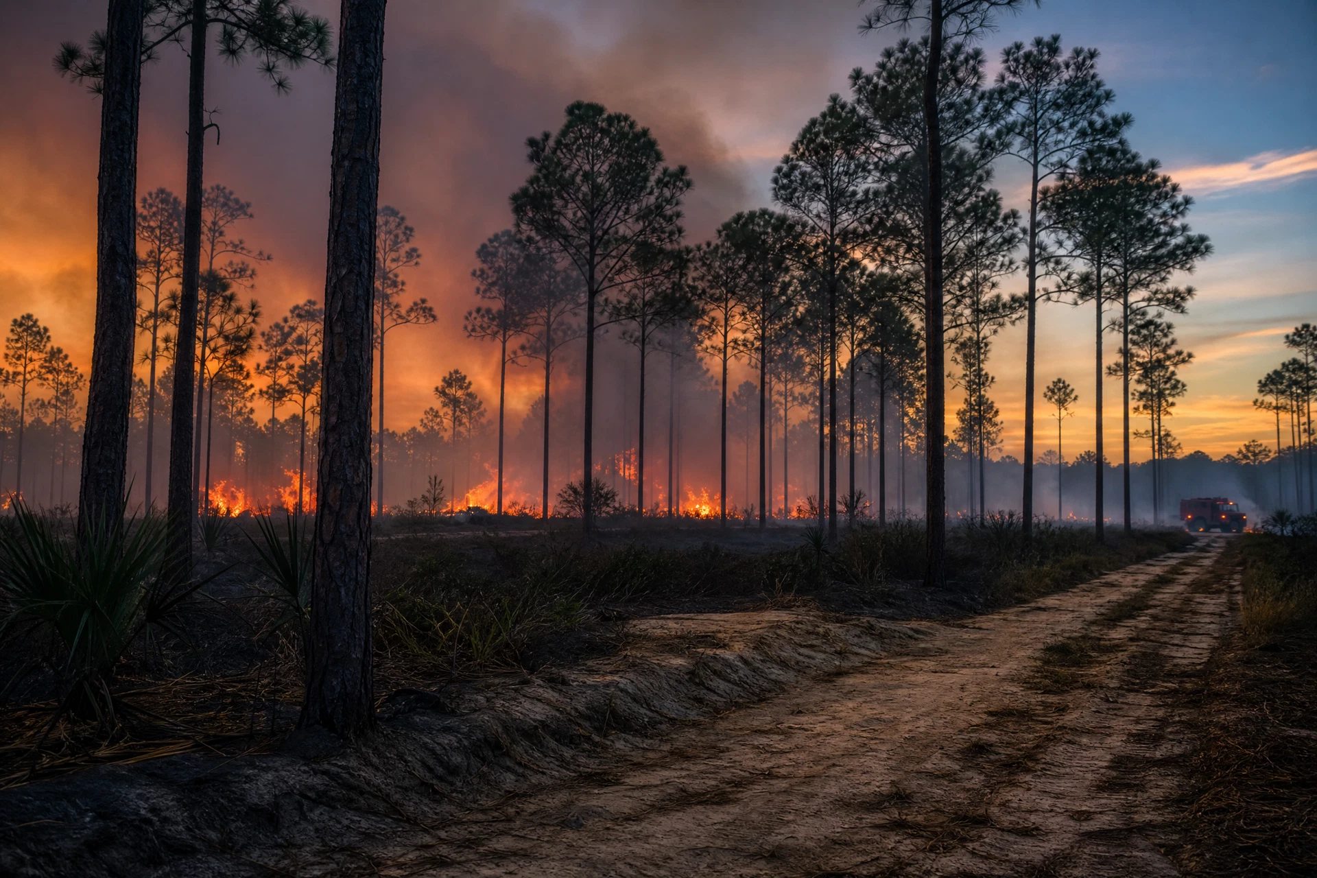
AI-generated editorial illustration — not a historical photograph. This original artwork provides wildfire context only and does not depict an actual Highway 31 Fire scene, person, vehicle, or property.
Earth Day, 2009. A guy east of Conway was burning yard debris. That's it. That's how it started.
Forty mile an hour gusts, humidity in the basement. The fire made a six-mile run through Lewis Ocean Bay that first afternoon and got to Highway 31. Nobody thought it could cross. There's more than thirty feet of easement out there.
It jumped 120 feet.
Overnight the wind shifted and it went across Highway 22 toward Barefoot Resort. And this is the part that still unsettles me — the main fire never reached most of those houses. Embers rode the wind a mile out ahead and landed in pine straw next to people's homes. The pine straw did the rest.
Final count: 19,130 acres, 76 homes destroyed, 97 damaged, about 4,000 people evacuated. Twenty-five million in property, another seventeen in timber.
The fire made its own weather. Crews on the line were reporting 45 to 60 mph winds while the airport a few miles away showed dead calm.
Nobody died. Nobody was seriously hurt. Read that again, because it's the only good sentence in this section.
Horry County now has more Firewise-certified neighborhoods than anywhere else in the state. That came out of this.
Sources: NWS Wilmington · SC Forestry Commission · WBTW · MyHorryNews
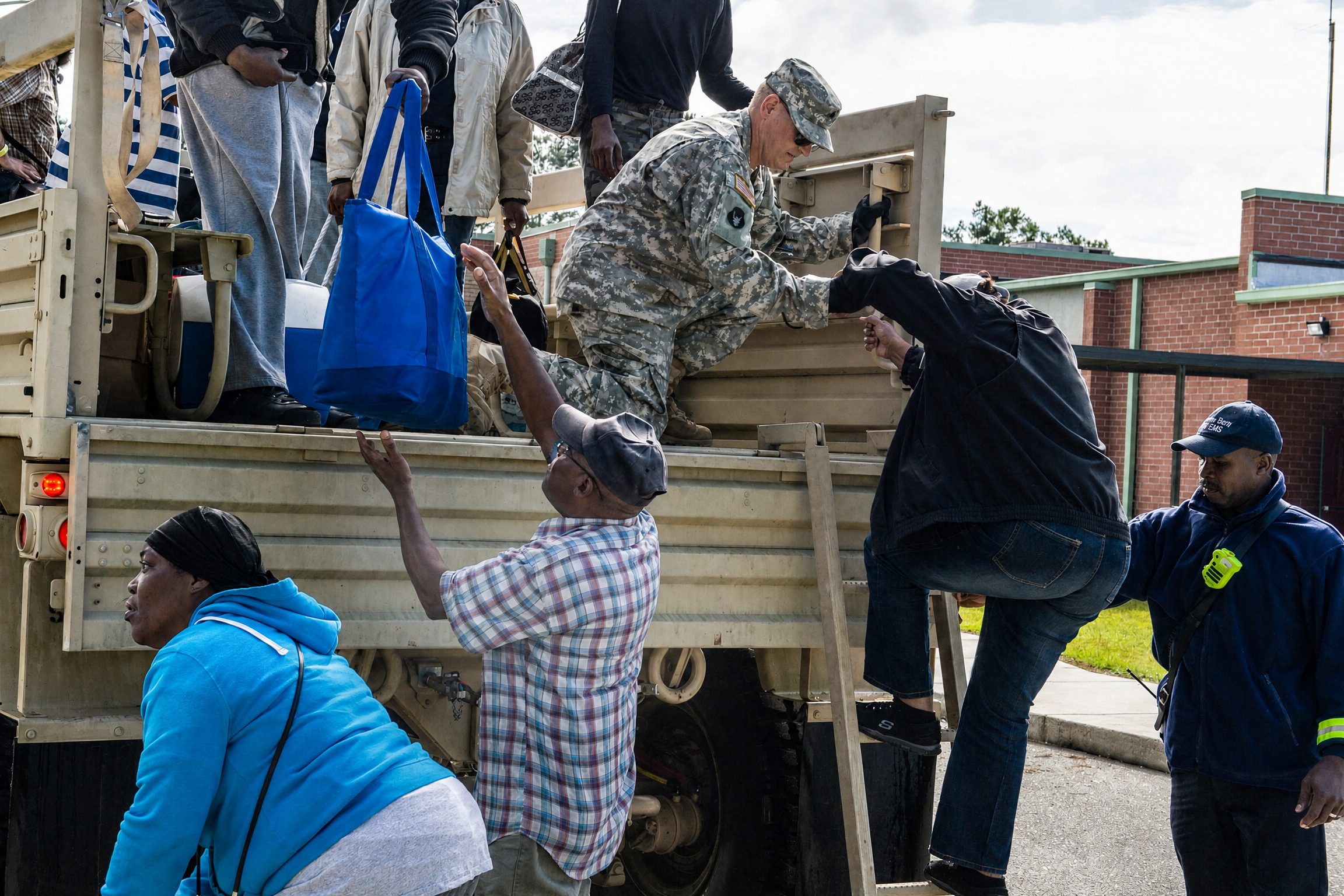
Photo: U.S. Air National Guard / Tech. Sgt. Jorge Intriago via DVIDS — public domain. National Guard flood response at Brown's Ferry, Georgetown County, October 11, 2015.
October 2015
No hurricane. No name. Nothing to board up for.
What happened was three things lining up at once: a stalled front, an upper-level low, and Hurricane Joaquin sitting well out to sea feeding tropical moisture into the whole mess. Joaquin never came close to landfall. It didn't have to.
Starting October 1st it just unloaded. Most of the state got over a foot of rain. Some spots measured more than twenty inches. NOAA later put the rainfall probability somewhere between a 1-in-100 and a 1-in-1,000 year event depending on where you were standing, which is where the "thousand-year flood" name came from.
Rivers came up everywhere, the Waccamaw included. Houses in Socastee flooded that had never taken water before, and their owners had no reason to think they would.
It caught everybody off guard. Then it happened again the next year.
Sources: WPDE · SC Sea Grant
Matthew, October 2016
Twelve months later, Matthew ran up the coast and dumped rain into ground that hadn't dried out yet.
The Waccamaw at Conway hit 17.9 feet. New record. The same houses that flooded in 2015 flooded again, including neighborhoods along the river where the post-Floyd buyouts had only been half finished, because some people took the money and some didn't. Horry County's emergency management director described what was left as donut holes.
Matthew also took the Surfside Beach pier — the second time that pier had been destroyed by a hurricane, after Hugo flattened it in 1989. The replacement turned into a years-long, $20 million saga of delays. By the summer of 2023, seven years after Matthew, the town had suspended its volunteer pier committee with no opening date set.
Two floods, one year apart, for people who'd gone their entire lives without one. And a town without its pier for the better part of a decade.
Sources: SC Sea Grant · MyHorryNews
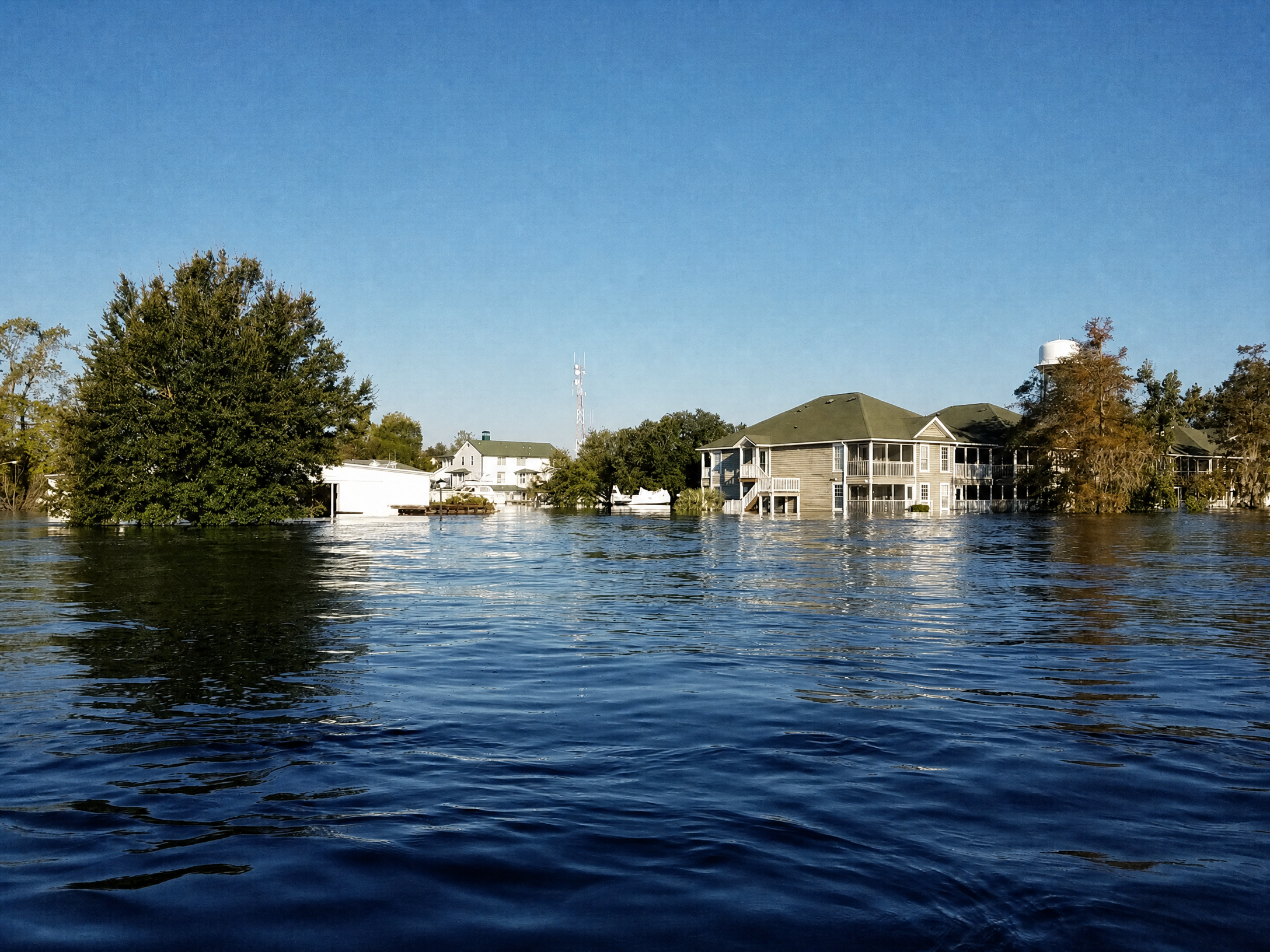
Photo: National Weather Service Wilmington — flooding near the Conway City Marina during Hurricane Florence.
Florence, September 2018
Florence landed in North Carolina as a Category 1 on September 14th and then just refused to leave. It crawled. At points it was moving two miles an hour, which is slower than you walk, and it wrung itself out over the Carolinas for days.
Down here, nothing much happened. And then everything happened, a week late, from upstream.
The Waccamaw at Conway crested around 22 feet. That's two and a half to three feet over the record Matthew had set two years earlier. Nearly a thousand homes and businesses in and around Conway went under, and a lot of them stayed under for weeks.
Crews built walls out of concrete barriers, plastic sheeting, and sand to keep the water off the 501 bridges. That's the main road into Myrtle Beach. It held. Barely, but it held.
Bucksport and Socastee flooded for the third time in four years. The state was still telling people to stay out of Horry and Georgetown counties almost two weeks after landfall.
This is the storm I left for, and I left for the wrong reason. If you want to understand how flooding works here, study this one.
Sources: NBC News · AP via Fox · Euronews drone footage
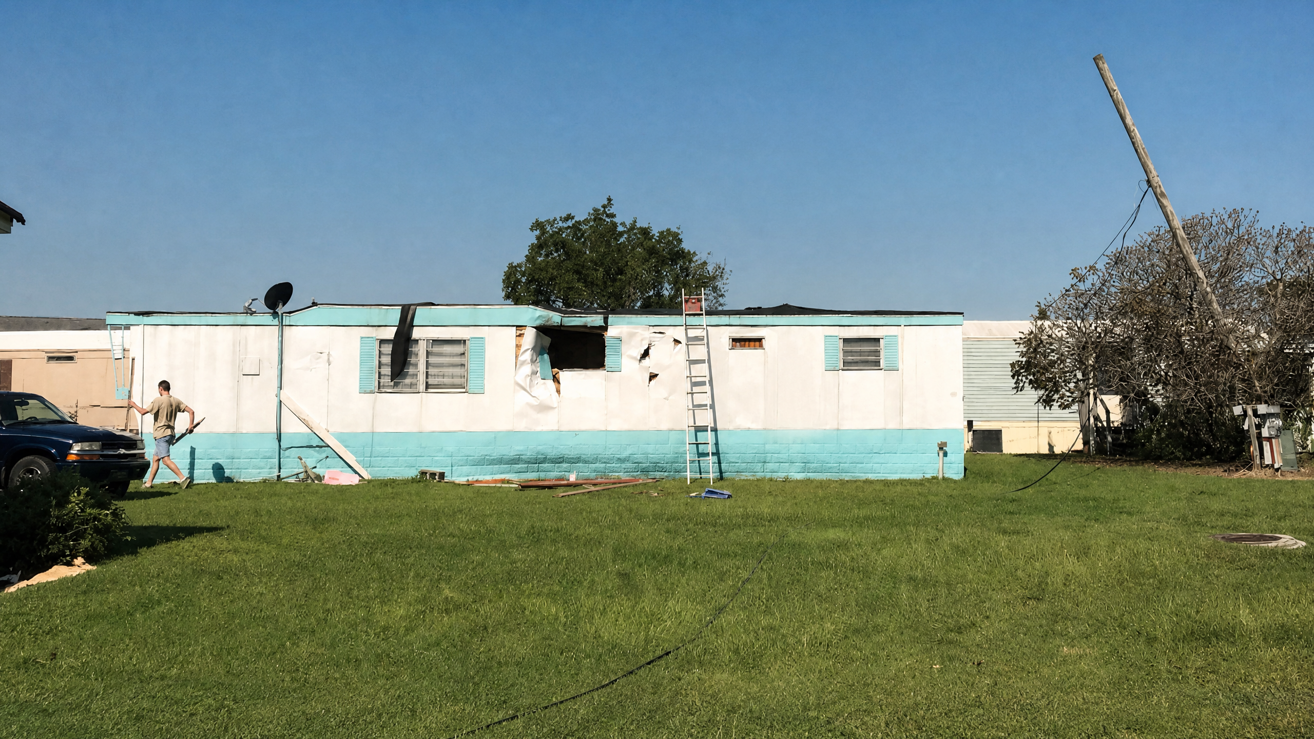
Photo: National Weather Service Wilmington — public domain tornado damage at Waterway View Mobile Home Park in North Myrtle Beach during Hurricane Dorian.
Dorian, September 5–6, 2019
Dorian never made landfall here. Stayed offshore the whole time.
It still put three tornadoes on the ground in Horry County before most people were awake.
An EF1 hit Little River at 4:37 in the morning. It threw a chunk of wooden dock about 150 yards, snapped trees all through the neighborhood north of 17, and tore up roofs and siding in The Retreat before crossing 57 and 9. An EF0 dropped near Socastee at 5:45 in the Riverbend neighborhood. Another EF0 hit North Myrtle Beach at 6:37 and worked over the Waterway View Mobile Home Park — two mobile homes badly damaged, six more with minor damage, and a shed shoved into somebody's house. It kept going into the Carolina Keyes condos next door.
Rain was heavy too. Fifteen inches near Pawleys, ten and three quarters at North Myrtle. Six inches of water on Atlantic Avenue in Garden City two blocks off the beach. Knee deep on 49th in Cherry Grove. Pawleys lost dunes and the city called the erosion severe, with sand covering the whole length of Springs Avenue.
The lesson of Dorian is that a storm can miss you completely and still spend the morning throwing tornadoes at you in the dark.
Sources: NWS Wilmington, full damage survey · NHC report (PDF)
Ian, September 30, 2022
Ian tore Florida apart as a Category 4, came back out over water, and made its last landfall just south of Georgetown at 2:05 in the afternoon as a Category 1. Maximum sustained winds were 80 mph, reduced in NWS post-season analysis from the initial 85 mph estimate.
A Category 1. It took out five piers in an afternoon.
Cherry Grove got split in half. Pawleys, Apache, 2nd Avenue, and Sea Cabin all had partial collapses.
At Pawleys the surge broke off 267 feet of the 820-foot pier at about one in the afternoon. There's video of the end section floating away with the American flag still snapping over the gazebo, shot by a guy standing in a stairwell at Pawleys Pier Village, and it went everywhere. Pilings and decking washed up on the beach at Pawleys and DeBordieu for days. That was the third pier to stand on that spot.
Where those piers stand now. Cherry Grove came back first — partial reopening in March 2024, fully open by that July, rebuilt eight feet higher with reinforced beams and stainless bolts. North Myrtle Beach put the damage at over $13 million. Pawleys took much longer. The undamaged stretch reopened about a year after Ian, but the full replacement moved slowly through permitting. The contractor told town council in May 2026 that demolition and construction should get underway around the fourth anniversary of the storm, with a 14 to 18 month build after that. Which means Pawleys won't have its pier back before 2027 — going on five years for a Category 1.
The gauge at Springmaid measured water 5.17 feet above normal high tide. Homes on the barrier islands took up to four feet inside. Pawleys, Garden City, and Cherry Grove got the worst of it. Water came over the MarshWalk in Murrells Inlet and up against the boardwalk in Myrtle Beach.
Every time somebody tells me a Cat 1 is nothing, I think about that flag. For a current look at the coast's pier access, start with the Grand Strand fishing-pier guide.
Sources: NWS Wilmington, Hurricane Ian · NHC report (PDF) · Post & Courier · WPDE · Coastal Observer
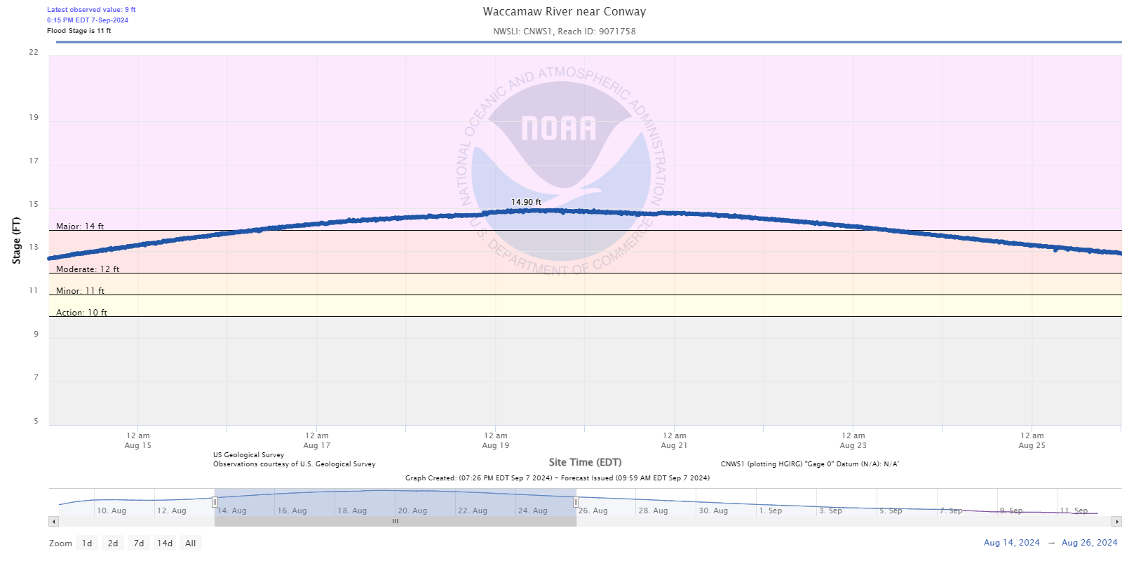
Graphic: National Weather Service Wilmington — Waccamaw River near Conway flood crest following Tropical Storm Debby.
Debby, August 2024
Debby wasn't even a hurricane when it got here. Second landfall near Bulls Bay on August 8th as a subtropical storm. Wind gusted to 48 at North Myrtle, 40 at Myrtle Beach. Tourists barely noticed.
Then it rained 19.03 inches along the Waccamaw.
Loris got 17. Little River got 15 and a half. Bucksport 15. Conway just under 14.
The Waccamaw near Conway crested at 14.9 feet, about a foot over major flood stage, and it did that almost two weeks after the storm was gone. The river didn't drop below minor flood stage until August 31st.
Three and a half weeks. From a storm that wasn't a hurricane.
If you only take one section of this whole post with you, take this one.
Sources: NWS Wilmington · NHC report (PDF)
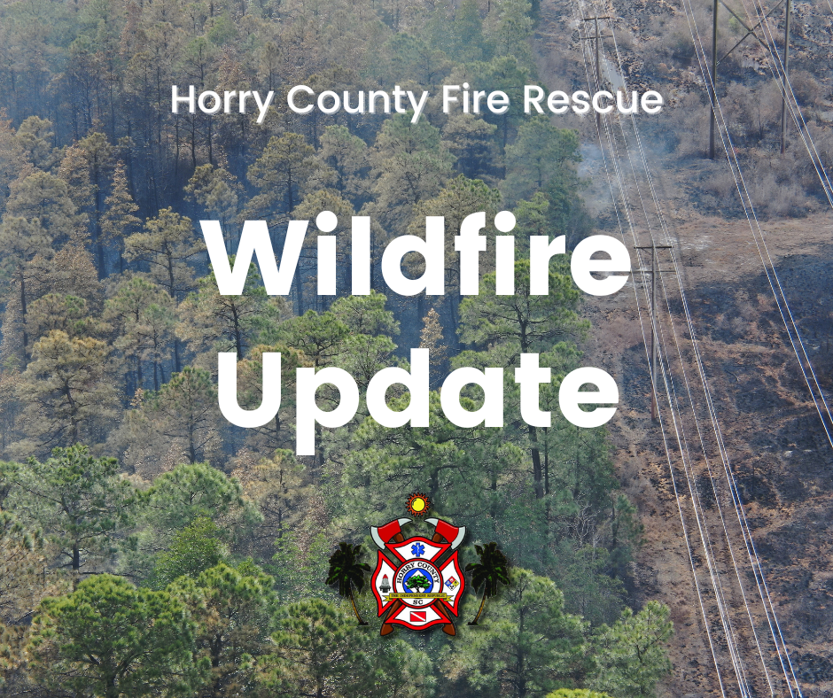
Graphic: Horry County Government / Horry County Fire Rescue — Covington Drive wildfire response update.
The Covington Drive Fire, March 2025
Another backyard burn. Sixteen years after Highway 31, in the same county, for the same reason.
March 1st, 2025. A debris burn on Covington Drive in Carolina Forest got away. Somebody was charged over it. And it happened on a day when the whole state was a tinderbox — more than a hundred separate wildfire ignitions in South Carolina in that one day, which is why the governor declared a statewide burn ban and a state of emergency.
They started evacuating Walkers Woods and Avalon that evening and it grew to eight neighborhoods. Forty-plus agencies, hundreds of people on it.
Final size was 2,059 acres. It hit 30 percent containment in two days and then just sat there, because the fire was underground. Peat. You can throw every bulldozer in the state at a peat fire and it will keep burning under your feet until it rains enough to raise the water table. That's not a figure of speech, that's literally what the county was telling people.
Full containment came May 21st. Eighty-two days. It wasn't declared controlled until June 4th, ninety-five days after it started, which makes it the longest-burning wildfire in South Carolina history.
Not one home lost. No injuries. Thousands of houses were sitting right there and the state forester came out and said flatly that if Horry County Fire Rescue hadn't held that line on structure protection, homes would have burned, no question.
If you lived in Carolina Forest that spring you remember the smoke. Months of it. People were describing their mornings as suffocating and they weren't being dramatic.
Sources: Horry County · MyHorryNews · WBTW one year later · WMBF
What Seventy Years Of This Actually Teaches You
The category number will lie to you. Ian was a Cat 1 and took five piers. Debby was subtropical and kept Conway flooded for a month. Dorian never made landfall and still threw three tornadoes at Horry County before sunrise. Watching the number on TV is how visitors get caught out.
The water shows up after the storm leaves. This is the single most local thing about disasters here. Hazel and Hugo were surge events, sure. But 2015, Matthew, Florence, and Debby all did their real damage days or weeks later, upstream, on the Waccamaw's schedule. Conway can flood on a sunny afternoon.
The piers tell you how bad it was. Hazel took every one on the coast. Hugo took Garden City, Surfside, and Pawleys. Ian took five in one afternoon. If the piers came through it, the storm wasn't much.
Fire is a Grand Strand problem, not a western one. The most destructive wildfire in South Carolina history and the longest-burning one both happened here, sixteen years apart, both started by somebody burning brush in their yard. If you live out near the bays — Carolina Forest, 90, Barefoot — get Firewise, clear the pine straw off your foundation, and check the burn ban before you light anything.
Every one of these rewrote a rule. Hazel is why we take June through November seriously. Floyd is why they reverse the lanes and why Conway builds two feet up. Highway 31 is why this county has more Firewise neighborhoods than anywhere else in South Carolina. After Covington Drive, lawmakers pushed a bill to raise the first-offense penalty for negligently starting a spreading fire from 30 days and $200 up to a year and $5,000 — though as of now the Forestry Commission's own burn-ban page still lists the old $200 figure, so that one hasn't landed yet.
Seventy years and this place has been flattened, flooded, and burned more times than most people realize. It's still here. So are we.
Get the app alerts. Know your evacuation zone before you need it. And when the storm passes and the sun comes back out, don't unpack yet.
Got a storm story? Hugo, Floyd, the fire, any of it? Drop it in the comments. This place runs on the stuff that never made the news. of they didn't want their favorite spot getting ruined. Can't say I blame them.
Here's what the talkative ones kept naming. No rankings, no scores — just the places locals couldn't help but mention.
The name that kept coming up: Socastee Station
If there was a consensus pick, this was it. Socastee Station came up more than any other spot in the whole thread — it was simply the default answer, the place that came to mind first. Nobody named a specific dish; they didn't have to. When that many different people land on the same place unprompted, that's the headline. If you only try one place off this list, make it this one.
Local favorites
These are the names that kept surfacing again and again:
Victoria's Country Kitchen — Down on 3rd Ave S in Myrtle Beach, serving country cooking that one commenter called "the absolute best." This is meat-and-three territory, done right.
Judy Boone's — Over in Murrells Inlet. "Excellent — we are there often," said one local, which is about as strong an endorsement as it gets. Regulars don't lie"="article-image-credit">Photo: exploregrandstrandsc.com
Bistro 90 — An upscale pick that locals clearly don't think of as a tourist spot, which is exactly why it belongs here.
Bimini's Oyster Bar & Seafood Market — Oysters and seafood with a market attached. When locals want seafood without the strip-mall markup, this is where they go.