How to Watch Rocket Launches from the Grand Strand
A plainspoken guide to watching Cape Canaveral launches from Myrtle Beach: flight direction, darkness, clouds, where to stand, what you’ll see, and how to catch Tuesday morning’s Bandwagon-5 attempt.
Category: guide | Published: 2026-10-19
Last Tuesday morning, half the East Coast woke up to a jellyfish in the sky.
At 6:33 AM on October 13, a SpaceX Falcon 9 lifted off from Cape Canaveral carrying supplies to the International Space Station. It launched about 45 minutes before sunrise, on a path that carried it northeast, up the coast. The ground below was still dark — but a few miles up, the rocket was already flying in sunlight, and its exhaust bloomed into a glowing, tentacled cloud that people photographed from Florida to New Jersey. The Grand Strand had a front-row seat and most of us slept through it.
Don't make a habit of that. The Cape is launching more rockets than ever — a record 109 went up in 2025 — and the Strand sits close enough to catch the good ones for free. Here's how to actually see them from here, honestly, including the mornings it isn't worth setting the alarm.
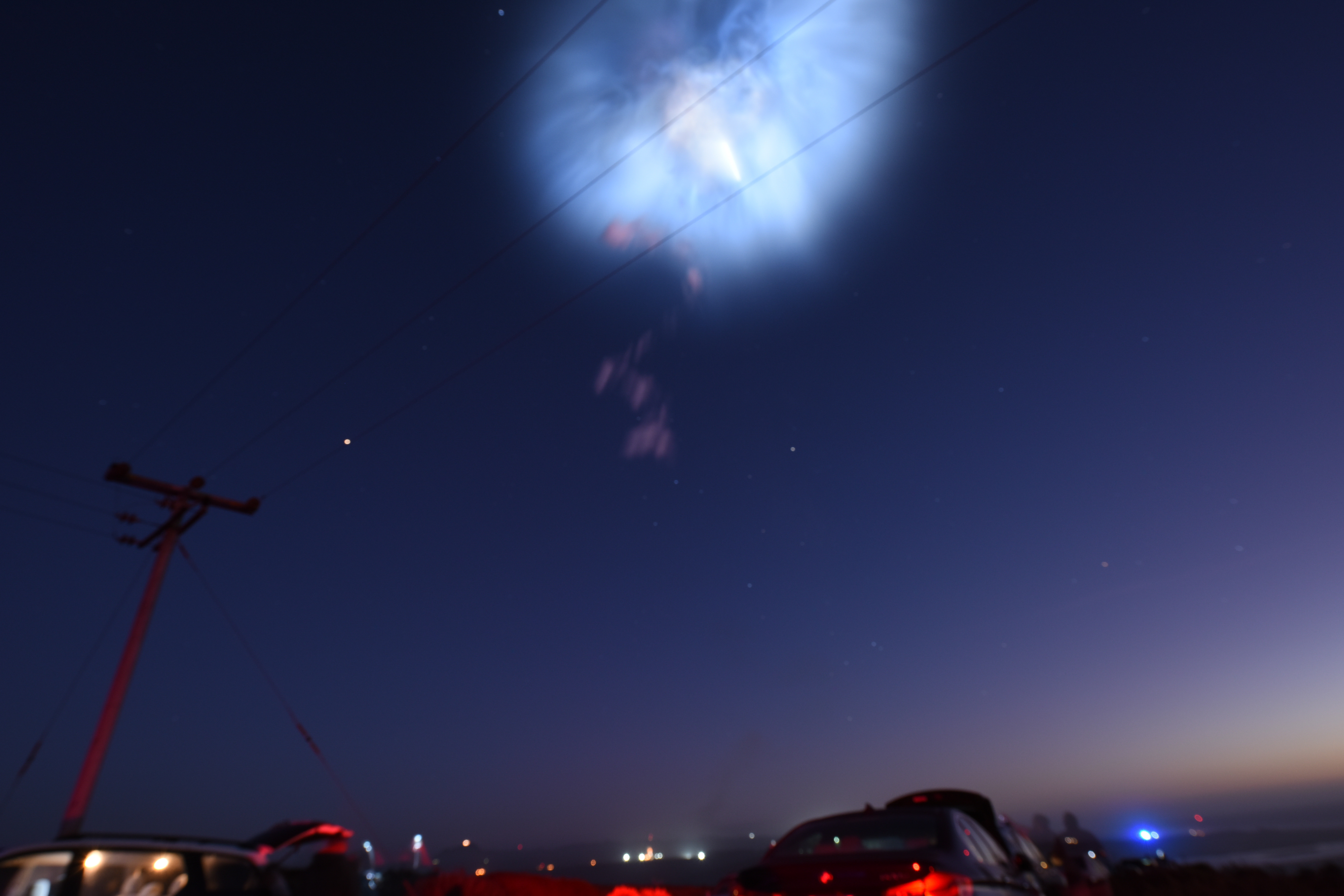 A Falcon 9's exhaust plume blooms into a "space jellyfish" at twilight. Photo: U.S. Air Force photo by Michael Peterson (public domain), via Wikimedia Commons.
First, the honest part
Cape Canaveral is about 370 miles south of Ocean Boulevard. At that distance you will never see a rocket on its pad, you will never hear one, and you will never feel the ground shake. Anybody who tells you different is selling something.
What you can see, on the right launch, is a light brighter than any star climbing over the ocean, an exhaust trail that lights up like a slow-motion firework — and once in a while, that full glowing jellyfish. Whether you get the show or a shrug comes down to three things: which way the rocket is headed, how dark it is, and the clouds. In that order.
Rule 1: Direction beats everything
Rockets leaving the Cape fly two main roads, and from the Strand they might as well be two different sports.
Northeast — the parade route. Missions headed to the International Space Station — crew flights and cargo runs — launch northeast, right up the East Coast. The rocket flies toward us and past us, a few hundred miles offshore, climbing the whole way. These are the can't-miss ones: bright, high, visible for minutes, and at dawn or dusk they're the ones that turn into jellyfish. Last Tuesday's show was a northeast flight. When you see "ISS," "Crew," "Dragon," or "cargo resupply" on a launch listing, that's your cue — set the alarm.
Southeast — the low road. Many satellite launches turn southeast instead, out over the open Atlantic away from the coast. From here they stay low to the water, briefly visible over the south-southeast horizon if they're visible at all. Tomorrow morning's Bandwagon-5 flight is a southeast launch with a 6:30–7:30 AM window — MBU will be out watching, but with honest expectations: a low, early brightening is a good outcome on a road like that.
Rule 2: Darkness is the multiplier
The same launch is a completely different event depending on when it goes up.
- Dead of night: the best pure view. A brilliant point of light climbs, arcs, and keeps going for minutes. On a clear night you can follow the first stage until it cuts off, around two and a half minutes in.
- Twilight — roughly the hour before sunrise or after sunset: jellyfish country. The ground is dark, but the rocket climbs into sunlight high up, and its exhaust — spreading wide in the thin upper air — catches the sun and glows. This is the one that makes the news and empties group chats.
- Broad daylight: from 370 miles, mostly forget it. Under perfect conditions you might catch a faint white contrail. Save your sleep for the dark ones.
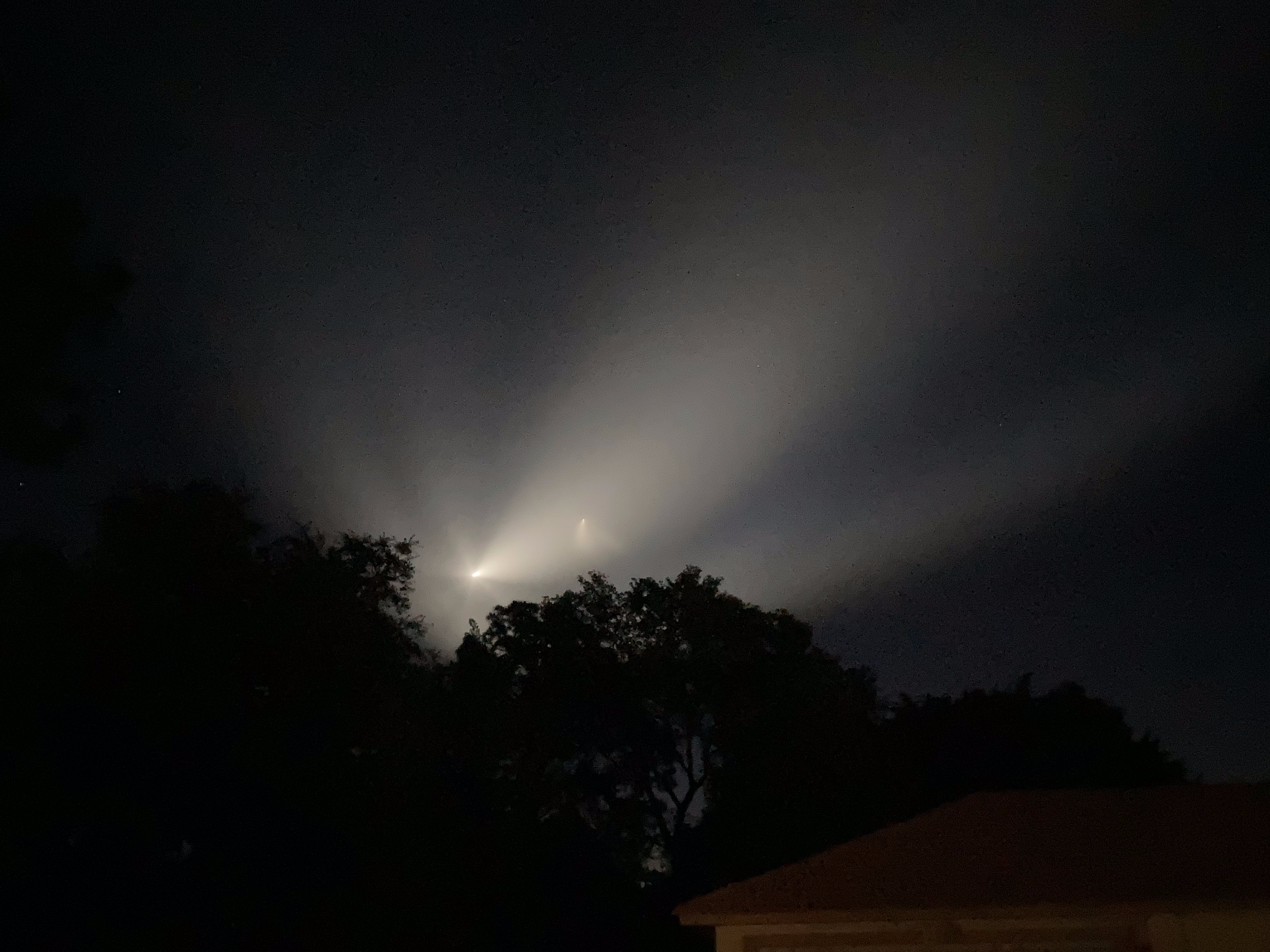 No two jellyfish draw up the same — the Crew-2 launch painted hers in spirals. Photo: ZLEA, CC BY-SA 4.0, via Wikimedia Commons.
Rule 3: Two skies have to cooperate
A launch needs clear weather at the Cape to fly at all — plenty scrub at the last minute for wind or storms down there. And it needs a clear sky here to be seen. A perfect launch under a Myrtle Beach overcast is a rumor. Check both forecasts before you commit to the alarm clock.
Where to stand on the Strand
You don't need a ticket, a tour, or a rooftop pass. You need an unobstructed view of the ocean horizon, and the Strand is 60 miles of exactly that.
- Any beach access, anywhere from Little River to Pawleys Island. The sand is the grandstand. For southeast flights, face low to the south-southeast. For northeast flights, start looking south — the show will travel up the coast toward you.
- The piers. Pier 14, Springmaid, Apache, Cherry Grove — a pier buys you height over the water and nothing in front of you but horizon.
- A south-facing balcony. High-rise folks on Ocean Boulevard have the best seats on the Strand and most of them don't know it.
- Get there early. Be in place ten minutes before the window opens. Launches go at the start of a window as often as not, and the whole first act lasts about three minutes. There is no encore.
What you'll actually see, minute by minute
T-minus 0: nothing happens here. The rocket leaves the pad 370 miles away, silent and invisible. Give it a few seconds.
First minute: a new "star" appears low over the water to the south — brighter than it has any right to be, and moving. On a twilight launch, this is when the plume starts to bloom and glow.
Around 2½ minutes: the bright light may wink, split, or flare — that's the first stage shutting down and separating. On night flights you can sometimes keep tracking the fainter second stage afterward.
Minutes 3–8: the light keeps climbing and shrinking toward the northeast (or fading low in the southeast), until it's a star among stars and then gone. The glowing plume, if there is one, can hang in the sky long after the rocket has left it behind.
The sequel: satellite trains
A day or two after a Starlink launch, the satellites it dropped off travel in a line — a slow string of pearls crossing the whole sky in formation. It looks unreal the first time you see it, and it startles somebody in a local Facebook group every single time. Free satellite-train trackers online will tell you the exact evenings a fresh batch passes over the Strand; the trains fade and spread out over a few weeks, so the nights right after a launch are the ones to catch.
Filming it with your phone
- Don't zoom. Phone zoom turns a rocket into a shaky blob. Shoot wide — the plume and the coastline are the story.
- Prop the phone against a railing or a beach chair and start recording a minute before the window opens. Let it run. Trimming is easy; the three seconds you missed are gone forever.
- Tap and hold to lock focus/exposure on the horizon if your phone allows it, so it doesn't go hunting when the bright light appears.
How to know when one's coming
Florida Today's launch coverage and SpaceX's launch page both list what's next from the Cape, and free launch-alert apps will buzz your phone — though be warned, liftoff times slide constantly for weather and a dozen other reasons. And when a good one lines up for the Strand — a dark sky and a northeast road — MBU posts a watch alert the night before, exactly like the one going up for tomorrow morning's Bandwagon-5 attempt.
So — tomorrow morning
Window: 6:30–7:30 AM, Tuesday, October 20. Flight path: southeast (the shy one). Sunrise: 7:24 AM, so the early part of the window is proper dark. Odds: genuinely uncertain — that's the honest forecast — but the coffee's already made either way, and dawn over this ocean has never once been a waste of an alarm.
MBU will be out there. If you catch it, the Strand wants to see it — drop your shots under MBU's morning post.